

National Weather Service image
The threat of spring flooding remains high across eastern Iowa, according to the National Weather Service. The risk for widespread minor flooding is above normal for all area rivers and the risk for major flooding on the Mississippi River is much above normal. Field Agronomist Rebecca Vittetoe says that going into the winter the Washington County area had wetter than normal soil conditions, and looking ahead there is some uncertainty, “Looking kind of at the outlook, at least for the next month or so, our temperatures are looking to be warmer than normal, so we will take that. The precipitation that’s the one that’s kind of the question mark. You see different outlooks and we kind of fall maybe slightly wetter, but then you also hear about equal chances or maybe drier. So, the climatologists really don’t know exactly on the moisture side of things. The one thing that I know that they are keeping an outlook on is the snowpack and what potentially could be coming down the rivers.”
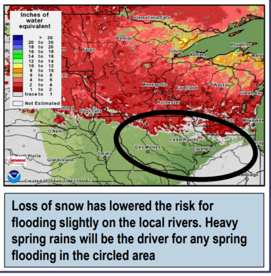
The NWS states the liquid water content across much of Minnesota and Wisconsin is above normal. There is low confidence at this time on the peak severity of eventual flooding this spring and flood potential is reliant on heavy spring rain. Until the soil is able to dry out, the flood risk will remain elevated.