

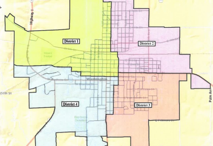
The above proposed map would keep the current boundary lines but would add one new area on the east side of town.
The Washington City Council is in the process of a once-every decade task, as cities and counties are required to redraw precinct lines following the 2020 Census.
City Clerk Sally Hart presented two possible options for reprecincting during the December 7th council meeting, as Iowa cities are required to finalize ward or precinct boundaries within 60 days of Governor Kim Reynolds signing legislation into law on November 4th for new congressional and state legislative district lines. The Iowa Secretary of State’s Office provided software to complete this work all electronically, and Hart explained the city’s current ward boundaries passed the software’s integrity tests for population breakdowns set by the state, and that they could keep these boundaries with the exception of having to move one block that includes Wiley Avenue south of Highway 92 that is currently in Ward 3 but must be moved to Ward 2 because it is required to be contiguous to the ward it belongs too.
Another option would be to draw new ward lines that would more evenly divide the population, but Hart recommended the first option, with Mayor Jaron Rosien echoing that choice, as they wouldn’t have to change routes for garbage pickup and such. The council approved setting a public hearing for their next meeting this coming Tuesday to review the ward map. Washington’s population grew from 7,266 in 2010 to 7,352 in 2020.