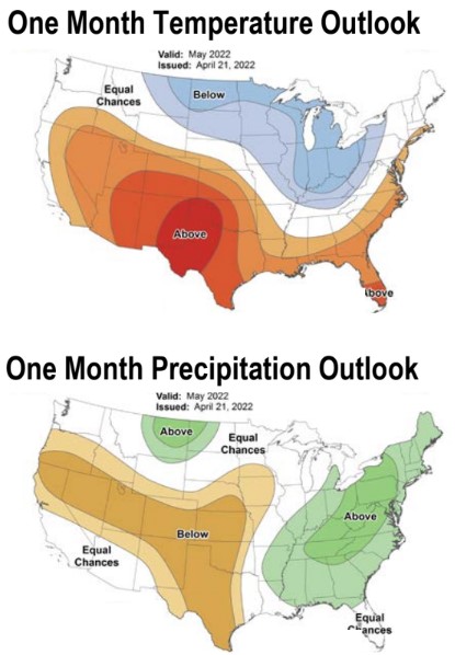
Courtesy of National Weather Service
Iowans are shedding layers and turning on the air conditioning this week, following an April that ranked as the 12th coldest for the state.
High temperatures in the 90’s and 80’s will continue through at least Saturday in the city of Washington, while temperatures averaged 4.9 degrees below normal last month according to State Climatologist Justin Glisan. When asked about wind conditions, National Weather Service Quad Cities Office Science and Operations Officer Ray Wolf says those statistics aren’t as readily recorded as temperature or precipitation, “But we know across the Midwest, actually the last couple months that it’s been windier than normal. Now usually, I mean late winter into spring is pretty windy to begin with being a transition season. But even so, on average, we’ve been couple to several miles an hour above normal which doesn’t sound like much but when you tally it up day in and day out it adds up pretty quickly.”
Wolf adds that a pretty active storm track across the Midwest during much of the last couple months has contributed to the increased winds in southeast Iowa. Below-normal temperatures and precipitation are predicted for most of Iowa this May, while drought conditions are likely to continue or worsen over the next three months, according to a climate outlook from the National Weather Service.

