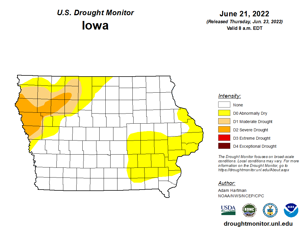
A stretch of above average temperatures and below average rainfall over southeast Iowa has allowed the expansion of abnormally dry conditions across the KCII listening area in late June. A comparison of maps from the U.S. Drought Monitor for the weeks of June 14th and June 21st, 2022, shows that all seven counties in the listening area are now experiencing abnormally dry conditions, with only the southern quarter of Henry county still reporting no drought related concerns. Overall 63% of Iowa is reported as normal with 25% abnormally dry, 6% experiencing moderate drought and 6% in severe drought. The drought affected areas are in the northwestern part of the state.
According to information from State Climatologist Justin Glison, the statewide average temperature last week was 75.4 degrees, 3.1 degrees above normal. Despite moderate to heavy rainfall across portions of eastern Iowa in the last week, where some locations received more than two inches above average, like 4.25 inches in Iowa City, the statewide average was only 0.91 inches with the normal being 1.05″. The majority of Washington County received between one half and one inch of rain in the last week. So far for the month of June in Washington 2.53″ of rainfall have been recorded this year, pacing behind the annual June average of 5.26″ during the month.
The extended forecast for the KCII listening area shows a chance of showers and storms to open July on Friday with temperatures in the mid 80s to 90 up through the Independence Day holiday. Stay tuned to KCII for weather updates.

