

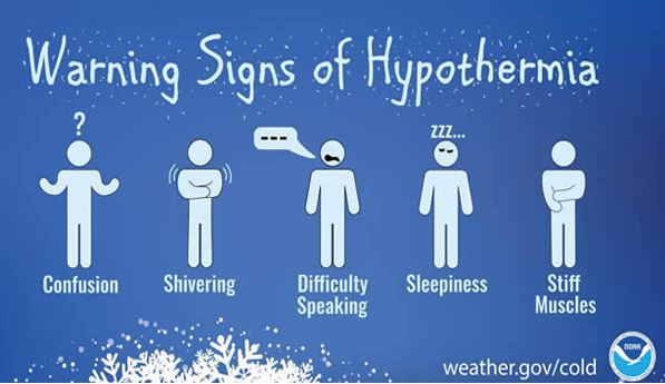
The National Weather Service has issued a winter storm watch for Southeast Iowa. The watch begins Wednesday night and will remain in effect through late Friday night. Blizzard conditions are possible with winds that could gust as high as 55 mph. Extreme cold wind chills will also be possible. Travel could be very difficult, with widespread blowing snow that could significantly reduce visibility. Strong winds could cause tree damage and potential power outages. The cold wind chills as low as 30 below zero could cause frostbite on exposed skin in as little as 30 minutes. Stay tuned to KCII for weather updates, including cancellations and delays, national weather service bulletins, and road conditions. The one to count on for up-to-the-minute weather coverage is AM and FM KCII and KCIIradio.com.