

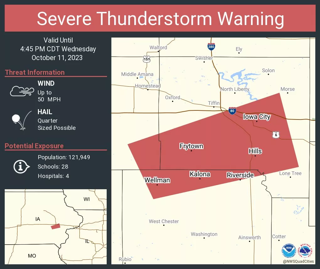
Just after 4p.m. Wednesday, the National Weather Service Quad Cities office issued a Severe Thunderstorm Warning for portions of northern Washington County, southeastern Iowa County and southern Johnson County in the KCII listening area until 4:45p.m. Radar indicated threats with this storm included quarter-sized hail and wind gusts up to 50 miles per hour. Locations in southern Johnson County including Frytown, Sharon Center and Hills received two-tenths of an inch of rainfall as the system passed through. The National Weather Service canceled the warning at 4:30, as the cell weakened below severe limits.
Five members of the KCII Severe Weather Action Team provided live coverage on the air. Had the power gone out, coverage would have continued with KCII’s back-up generators. Several rounds of showers and storms are possible in southeast Iowa through the end of the work week. The one to count on for up to the minute severe weather coverage is AM and FM KCII.