

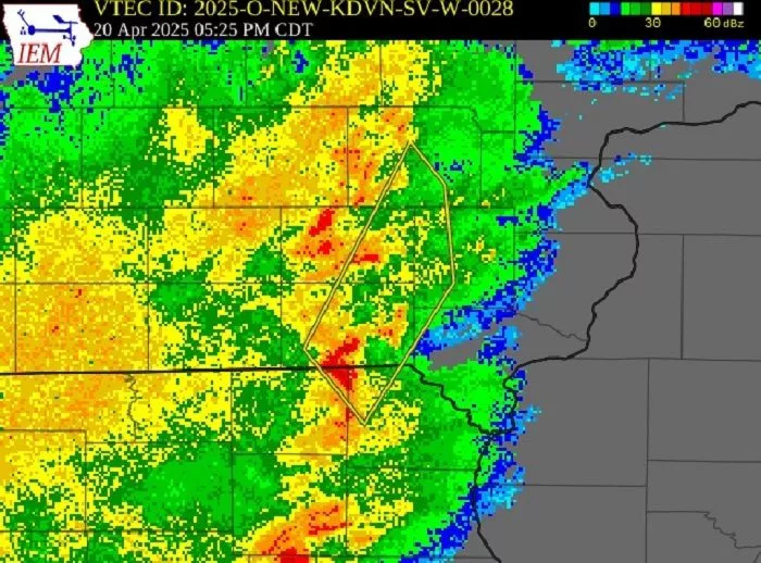
The Easter weekend saw April showers and severe weather Sunday. At about 5:25p.m. The National Weather Service Quad Cities Office issued a Severe Thunderstorm Warning for portions of Washington, Jefferson and Henry counties in southeast Iowa until 6:30p.m. NWS radar models indicated the storms had the potential to produce 60 m.p.h wind gusts and three quarter of an inch in diameter hail. Radar indicated rainfall rates were as high as two inches per hour in some locations as storms moved through. Highest rainfall totals recorded in the area through 7p.m. Were an inch and a quarter each in Brighton and Keota and an inch each in Kalona and Riverside. Three members of the KCII Severe Weather Action Team responded with live coverage on-air. Had power gone out, coverage would have continued with our emergency backup generators. The one to count on is AM and FM KCII.