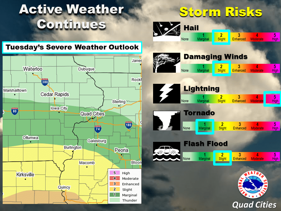
With the already saturated ground and more heavy rain expected, eastern Iowa is at a heightened risk for flash flooding this week. According to the National Weather Service, the flash flood risk has increased to slight. Washington County Emergency Management Coordinator Marissa Reisen says it doesn’t take much water to move a vehicle, “They develop very rapidly. It’s usually as a result of heavy rains. And as little as six inches of standing water with a current can knock you off your feet. And it only takes about a foot-and-a-half to wash away a small car. So if there’s ever standing water, don’t go into it on foot or in your vehicle.” Roads under the water could be seriously compromised.
The increased storm risk today also means a higher risk of lightning, damaging winds and hail. Strong thunderstorms will also be possible Saturday and Sunday. Listen to KCII for weather updates.

