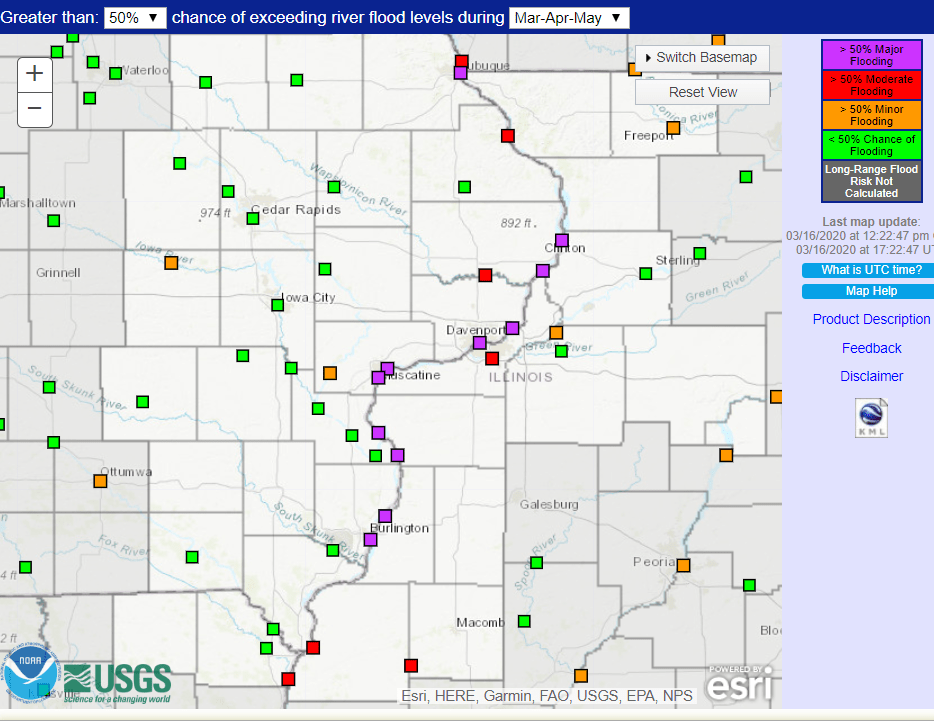
The spring flood risk is still above normal but has been reduced by the National Weather Service. In the final 2020 spring flood outlook, it is stated that there has been noticeable improvement in probabilities for flooding since the February 28th report.
Field Agronomist Rebecca Vittetoe said they’ve been keeping an eye on the snowpack in Minnesota and Wisconsin and how it will impact Iowa’s fields along rivers, “The snowpack further up north and upstream is one of the things that they’re concerned about, especially at how fast it decides to melt. And that’s going to obviously be a factor of what our temperatures are. So, I know our State Climatologist Justin Glisan said that we like the ’40-20 rule,’ highs in the 40’s, lows in the 20’s to slowly melt that snowpack, and not just have it melt all at once and then we’re bombarded by a lot of water.” The probability of exceeding major flooding dropped from 94% to 59%, due to favorable snow melt and a prolonged dry weather.
The severity of flooding will depend on additional rain and snow that falls this spring, and the potential for widespread flooding is near normal for all rivers in the area. The moisture levels in the soil have persisted through the winter from last fall and a higher flood risk will extend through the spring if the soil moisture remains high.

