

As Iowa prepares to experience the La Niña climate pattern, the state climatologist gives a look into what they can expect for weather in the coming months.
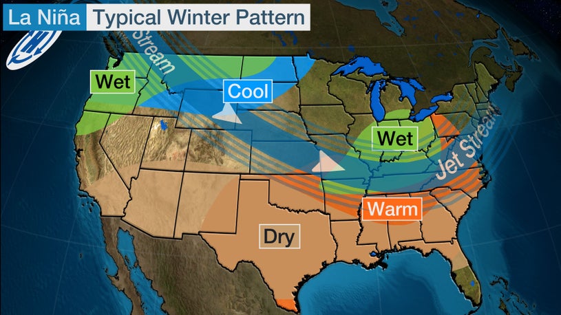
Cooler than average water temperatures in the Pacific Ocean have led to the formation of another La Niña. States in the north often experience an elevation in precipitation while states to the south have an elevated chance for above average dry conditions. State Climatologist Justin Glisan says that with Iowa sitting in the middle of the United States, the state could experience a mix of cold air outbreaks and warmer than average temperatures. He shares the expected outlook for this fall and winter, “Basically what we’re looking at is similar behavior as what we had last year. Which was basically near average temperatures through December, January and February. Perhaps a slightly larger snow pack across the northern part of the state, southeastern Iowa basically on that periphery of the probability. It’s always difficult to get a seasonal forecast because precipitation behaviour in La Niña is so variable.”
Glisan added that the monthly outlooks moving forward will help provide a more clear picture of what Iowa can expect. He says that while overall outlooks look similar to last year, impacts from this year’s La Niña may be less severe.