

Equal chances for above or below normal temperatures and chances of above normal precipitation are predicted for southeast Iowa this coming February.
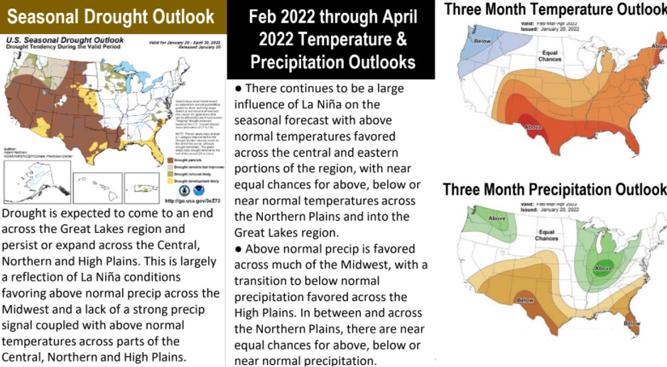
The National Weather Service recently published its Central Region Climate Outlook which gives a one-month outlook on temperature and precipitation and a three-month outlook for February through April. National Weather Service Quad Cities Office Science and Operations Officer Ray Wolf says La Niña-like conditions are predicted to be more prevalent later in the month of February. During a La Niña event, cold waters in the Pacific Ocean push the jet stream northward which tends to lead to drought in the southern U.S. and heavy rains and flooding in the Pacific Northwest and Canada. The February outlook shows below normal temps for the northwest part of the U.S. and above normal temperatures for the southern region, which is pretty typical for a La Niña pattern, according to Wolf. He comments on Iowa’s climate chances, “We’re not really seeing a strong indication as to whether warmer or colder than normal temperatures are favored but we do see the possibility for being broad favoring a little wetter than normal period for February, March, and April, and that wouldn’t be a bad thing altogether given the dryness that we’re seeing across the region.”
Washington County and southeast Iowa has maintained abnormally dry soil conditions through the winter according to the U.S. Drought Monitor. The three-month outlook also shows the eastern part of Iowa on the edge of a region showing chances of above normal precipitation, with the southwest and southeast tips of Iowa showing above normal temperatures. You can hear more about the climate outlook in today’s Halcyon House Washington Page on air and at kciiradio.com.