

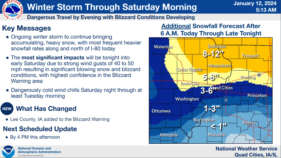
A trio of Winter Weather Alerts have been issued for southeast Iowa by the National Weather Service: The National Weather Service in the Quad Cities has issued a Winter Storm Warning for the entire KCII listening area through 5p.m. Friday, January 12th. Heavy snow is expected in the warned area with a period of mixed precipitation possible. Total snow accumulations of seven to 14 inches are forecast with a light glaze of ice. Northeast winds are expected to reach 40mph at times Friday morning and afternoon. Travel will be very difficult with significant blowing and drifting snow. Gusty winds could bring down tree branches causing possible power outages. If you must travel, have a winter survival kit with you that includes a flashlight, food, water and blankets. The National Weather Service in the Quad Cities has issued a Blizzard Warning for the entire KCII listening area from 5p.m. Friday, January 12th to noon Saturday, January 13th. Total snow accumulations of seven to 14 inches are forecast in southeast Iowa. The precipitation, coupled with wind gusts up to 50mph at times Friday evening and overnight, will result in blizzard conditions. Travel will be difficult with significant blowing and drifting snow resulting in whiteouts. Flash freezes on roadways are also possible due to windy conditions. Gusty winds could bring down tree branches causing possible power outages. If you must travel, have a winter survival kit with you that includes a flashlight, food, water and blankets. The National Weather Service in the Quad Cities has issued a Windchill Watch from 6p.m. Saturday, January 13th to noon Tuesday, January 16th for the entire KCII listening area. Dangerously cold wind chills down to 40 below zero are possible across southeast Iowa during the watch. Frostbite could occur on exposed skin in as little as 10 minutes. Stay tuned to KCII for all weather updates.